OVERVIEW
Really only suitable for centre board or lifting keel vessels and skippers with confidence in their tidal calculations and vessel, (Ideal for OVNI Yachts )
Strong tidal flows on both the ebb and the flood. On the flood tide the flow is initially in the many shallow channels but once those fill the tide then races across the dried-out area with surprising speed and power.
Anchor between Mont Saint Michel and Rocher de Tombelaine, approximately
2.5 Km to the north. Use Google Earth or other satellite images, together with charts, to check out where deeper channels may be, realizing that these may change over time.
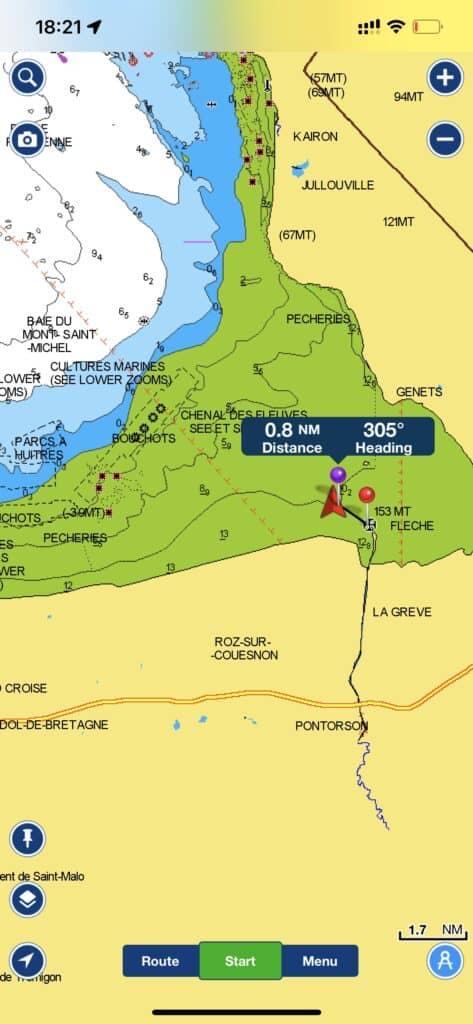
Our exact anchoring/drying out location.
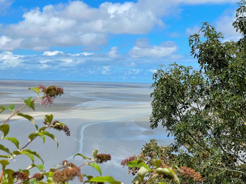
A huge area dries at low water as you can see from the green area on the chart
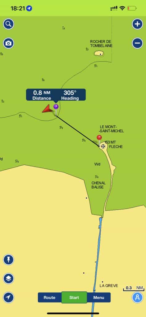
A closer view as to where we dried out.
Only a 1.5km walk to the Mont, or so we thought!!
Approach/Entrance
Approach on a rising tide (Ideally a few days before spring tide) carefully tracking your progress and comparing charted depths with actual depths having allowed for the current rise of tide.

A Google Earth view of where we dried out.
An additional and useful tool to see where the river flows are. Be carefuul as these change over time.
We used Google Earth, Electronic Chart and off Course up to date paper chart to make a all round decision and plan.
It’s not often that you anchor at drying height of 9 metres.
As we entered the bay we turned on the tracking on our plotter, so as we could exit on the same route if needed.
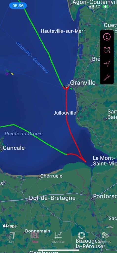
This shows our track in and subsequently out of Mont Saint Michel.
The entry route is primarily Green and our exit to Granville in the red.
This chartlet provided by my Log Book app www.logbook-app.com The green is sailing and the red motoring.
Shelter
No shelter, only plan a visit with favorable light winds forecast and complete tidal information.
.
Berthing
No facilities at all. This is a settled weather only anchorage severely restricted by the tidal range.
Holding
Good holding in primarily sand and some mud.
Allow plenty of scope to allow for the predicted rise of the tide once you re-float.
A second anchor with good holding power will help hold the yacht with its bow towards the expected direction of the flood tide. You can work this out by watching the ebbing tide as it exposes the channels. Of course, you may be aground by then in which case walk the second anchor out.
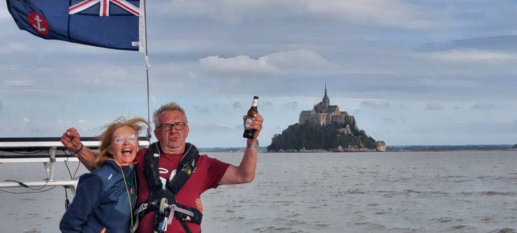
Celebration on arrival. We had 1.8 metres of water on arrival
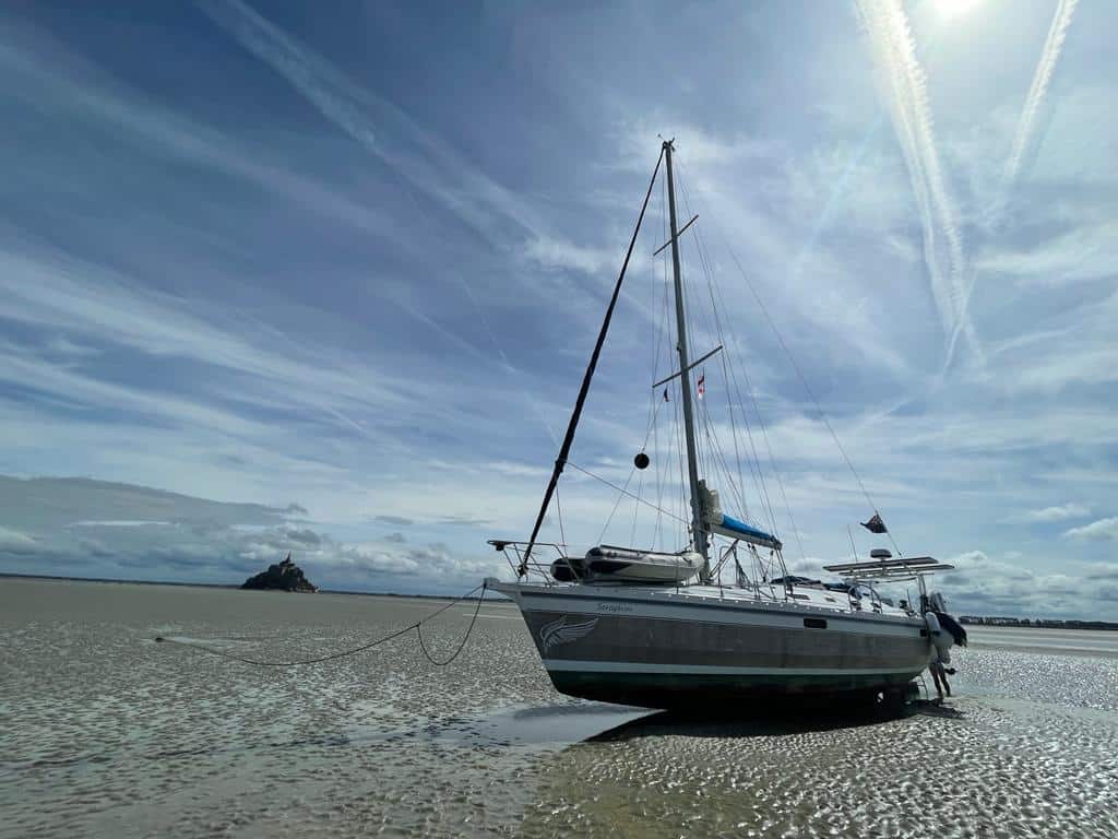
Seraphim, dried out with Mont Saint Michel 1.5kms in the distance
Landing
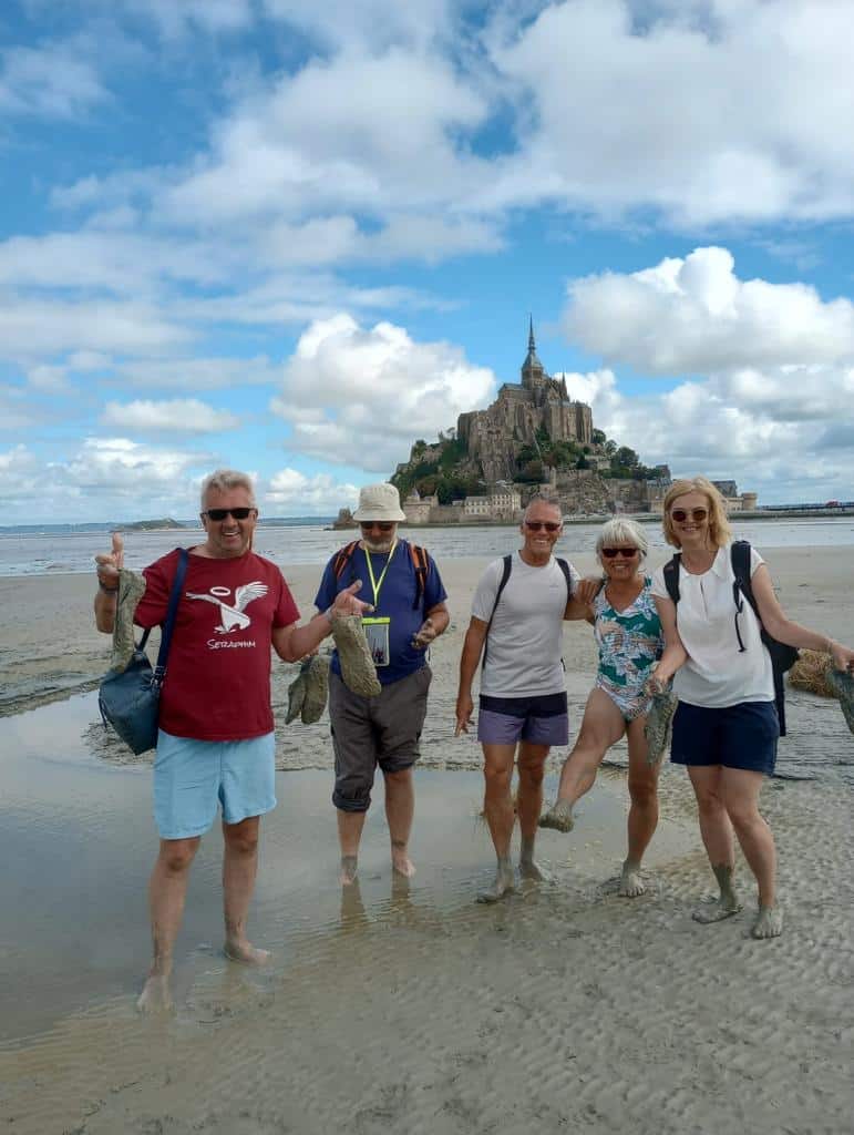
The CREW, covered in mud from our walk ashore.
Walk ashore once the tide fall allows for this. Be aware that there may be areas of soft ‘sinking sand’ mostly on the edges of channels and pools.
ALLOW LOTS OF TIME FOR THE WALK BACK TO YOUR YACHT.
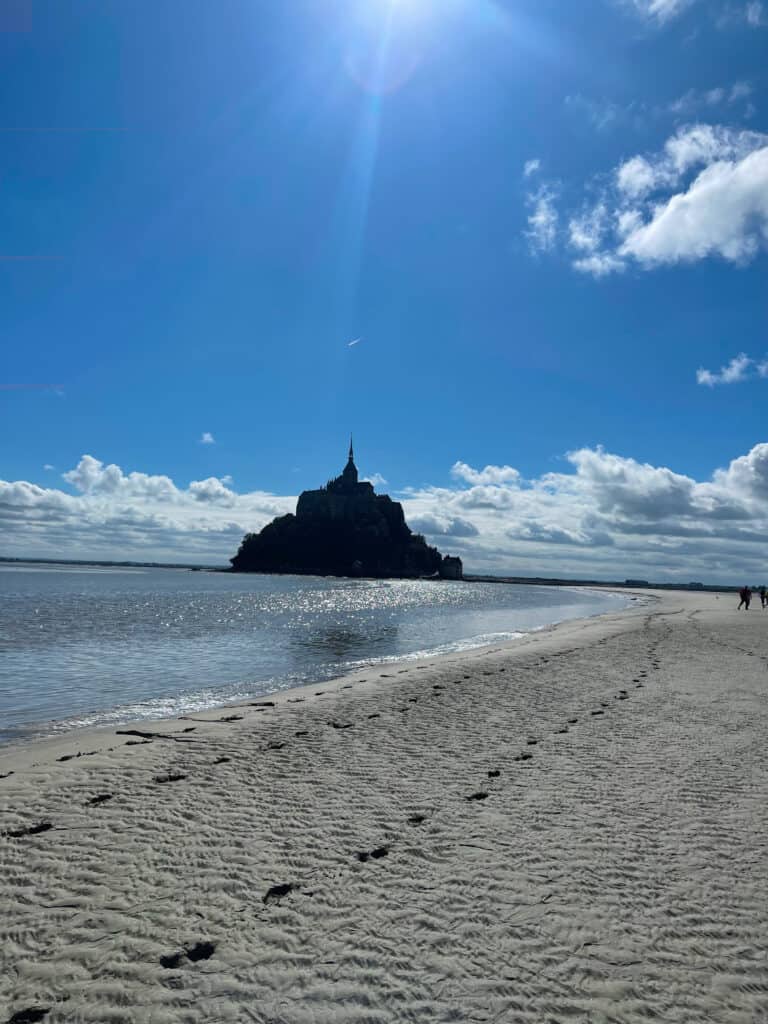
Walking to the Mont, the long way unless you fancied wading through the river.
The flood tide arrives with surprising speed and would easily sweep you off your feet if caught in knee deep water. Aim to be back on board while still fully dried out and with lots of safety margin.
We arrived back with a couple of hours to spare, which gave us the opportunity to inspect our hull, anodes, and scrape off any small sea life and generally re abrade the Copper Coat anti fouling.
Other
An amazing place to dry out and visit the Abbey (buy tickets to the Abbey online and then use the ‘pre-booked’ queue for access, this saves an amazing amount of time, as other queues are massive. No charge for just walking grounds, ramparts, streets, shops and numerous food outlets.
Seraphim dried out in the distance, as seen from Mont Saint Michel
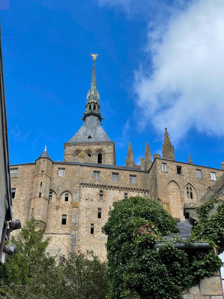
Mont Saint Michel – a worth while visit and plenty of memories to last a lifetime.
Our experience
14th August 2023. We dried out at location 48° 38.737 N 001° 32.031′ W and then we attempted to walk ashore, approximately 2 Km directly to Le Mont. The river channels thwarted that plan as none of us fancied being deep in the mud or swimming the river and then getting muddy exiting onto the harder sand.
Instead, we walked ashore to the west of the river, walked to the bridge over the sluice and then caught the free bus to the Le Mont Saint Michel. That all took a lot longer than expected so it restricted the time we had to explore the abbey and the village.
Next time we would aim to anchor between Le Mont and Rocker de Tombelaine to the north and then be able to walk ashore more easily. This would however mean the yacht could easily be reached by other tourists walking around at low water on guided walks or on their own.